Tuesday at 8: 00 p. m. ET, Environnement Canada forecasts a significant weather downgrade for Quebec, with freezing rain expected in several southern regions and heavy snow in the north, meteorologist Raja Rapaic said. Journal De Québec coverage highlights why the timing matters now: a tracked system is due to cross the province beginning Tuesday evening and models show conditions ripe for mixed precipitation.
February’s dryness framed the lead-up to this system: the federal climate review labeled the month “exceptionally dry, ” with Montréal recording 0. 2 mm of rain against a 16. 9 mm normal, underscoring how recent precipitation deficits contrast with the coming multi-type episode.
Environnement Canada lays out where freezing rain and icing are expected
Environnement Canada forecasts an initial period of rain Tuesday that will change to freezing rain in multiple southern regions, with the Grand Montréal area, the Outaouais, the Laurentides, the Mauricie, the Quebec region and the Beauce specifically named as likely to see substantial icing. A special weather bulletin cited totals of 20 to 30 millimeters of freezing-rain accumulation possible for Grand Montréal and adjacent regions, and noted an episode that could last up to 24 hours in the worst-affected corridors.
Because freezing rain forms when warm air moves over a thin layer of colder air at the surface, the agency cautioned that this pattern could create widespread hazardous surfaces and disruptions to services in the listed regions.
Journal De Québec: north of the Saint-Laurent faces snow and wind
Raja Rapaic summarized the system as “une grosse tempête” that will deliver snow and blowing snow north of the Saint-Laurent valley while the south contends with verglas. The Saguenay–Lac-Saint-Jean region, Rimouski and the Gaspésie are identified for potentially large snow accumulations beginning Wednesday, with wind on Wednesday and Thursday likely to produce poudrerie and difficult driving conditions in eastern and northern sectors.
In areas impacted by freezing rain, precipitation is expected to transition back to snow in the night from Wednesday to Thursday, and snowfall should persist from Thursday into Friday as temperatures begin a gradual decline, extending wintry conditions across multiple sectors of the province.
Local impacts and practical precautions ahead of the storm
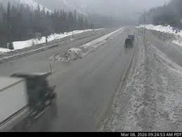
Transport and infrastructure disruptions are the primary near-term concerns where freezing rain accumulates. The bulletin’s 20-to-30-millimeter figure for icing in Grand Montréal and surrounding areas signals a risk of prolonged slick conditions that can immobilize services and complicate travel. In northern zones, significant snowfall combined with gusty winds raises the prospect of low visibility and drifting that will hinder road travel.
Residents in the listed regions should prepare for a sequence of precipitation types — rain, freezing rain, sleet and snow — within short distances, and plan for a period of persistent icy conditions where freezing-rain totals are highest.
Environnement Canada has the storm under active watch; more detailed bulletins and timing updates are expected Tuesday at 8: 00 p. m. ET. If the freezing-rain accumulations reach the higher end of the bulletin’s range, utility and travel disruptions are expected to last through the following 24-hour window.