A major Michigan Snow Storm is set to arrive Saturday night and continue through Tuesday morning, with blizzard warnings issued for much of the Upper Peninsula and multiple rounds of heavy snow, freezing rain and damaging winds expected to make travel extremely hazardous.
Michigan Snow Storm: Warnings and Three Phases
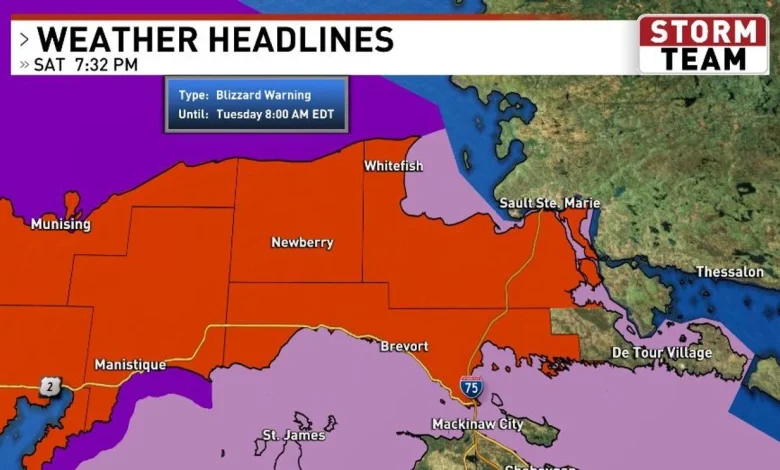
Officials have issued Winter Storm Warnings in the tip of the mitt in the northern lower peninsula, Blizzard Warnings across most of the U. P., and Winter Weather Advisories for much of the northern lower peninsula. The event is expected to unfold in three distinct phases.
Phase 1 begins late Saturday night with an initial burst of snow. Most areas are forecast to receive about 3–6 inches, with some localized amounts near 8 inches overnight into Sunday morning. Brief periods of reduced visibility and snowfall rates of 1–2 inches per hour are possible during this stage.
Phase 2 will favor mostly snow across much of the U. P. and the tip of the mitt, with blizzard-like conditions and visibility near zero at times. Snowfall rates could reach 1–3 inches per hour in the heaviest bands. Some areas, particularly near Drummond Island, may see freezing rain mixing in. Regions generally along a line from Petoskey to Cheboygan south, and from Manistee to Alpena north, have the best chance of significant icing late Sunday morning through early Monday morning, with ice accumulations of one-quarter to three-quarters of an inch possible.
Phase 3 brings much colder air late Sunday into Monday, allowing heavy snow to return to most of the area. Some locations in the U. P. could pick up an additional 1–2 feet of snow, while most of the northern lower peninsula may see around 6–12 inches. Amounts will taper off to the south and east.
Where Snow, Ice and Severe Weather Could Strike
The heaviest snow and blizzard conditions are expected in the Upper Peninsula and the tip of the mitt, where warnings are concentrated. Eastern U. P., the Straits region and the tip of the mitt could experience heavy snow for much or all of Sunday. Northern Lower Michigan may see intermittent breaks, but the threat of freezing rain and significant ice increases during Sunday afternoon and evening in areas south of a Rogers City–Petoskey line.
South of US-10, the system is more likely to fall as rain for a time, and the forecast includes a marginal to slight risk of severe weather in those southern areas. Damaging winds and large hail are identified as the primary severe threats, and an isolated tornado downstate cannot be ruled out, principally in areas south of M-20. Timing, track and amounts are subject to change with new model runs.
Timing, Winds and Travel Impact
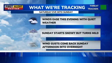
The storm begins Saturday night, mostly after midnight, as snow lifts northward. Overnight accumulations may amount to an inch or two before Sunday’s main impacts. Forecast low temperatures range from the upper teens to low 30s Fahrenheit during the initial period, with southeast winds of 10–20 mph.
Sunday’s high temperatures are expected to span roughly 25–54F as winds shift from southeast to northeast and strengthen to 20–30 mph with gusts of 45–50 mph. Sunday night will bring heavy snow continuing north, freezing rain and the potential for crippling ice in parts of Northern Lower Michigan; winds are expected from the northeast at 20–35 mph with gusts to 50 mph. Travel will be nearly impossible across much of the area because of the combination of heavy snow, ice and strong winds.
By Monday, freezing rain is expected to taper off by mid-morning as colder air returns and precipitation transitions back to snow at times. The combination of strong winds and heavy snow will produce near-blizzard conditions in some locations.
The situation remains fluid: timing, track and amounts will likely vary as new model runs come in. Residents in affected areas are advised to prepare for prolonged disruptions to travel and utilities and to expect rapidly changing conditions.