Environment Canada warnings for Sault Ste. Marie and the Kirkland Lake area both warn of disruptive winter conditions, and this comparison asks: which community faces the greater near-term travel and safety risk? The headline contrast hinges on snowfall amounts, the mix of freezing drizzle and snow, and the stated timing for when precipitation will end or continue — all central to how residents should prepare under pei weather guidance.
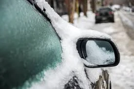
Sault Ste. Marie: freezing drizzle switching back to snow, near 10 cm
Environment Canada has set a yellow-level snowfall warning for areas including Sault Ste. Marie and nearby districts, with snowfall amounts near 10 cm expected. Forecast confidence is listed as high and the impact level as moderate, reflecting that light ice accumulations from freezing drizzle are already present this morning and will transition to all snow this afternoon. The forecast says the snow should intensify after the transition and then taper off this evening, and local blowing snow and reduced visibility are specifically noted as travel hazards.
Kirkland Lake: larger accumulations and a longer-duration warning
For the Kirkland Lake area, Environment Canada issued a snowfall warning calling for 10 to 20 cm of snow, with local blowing snow expected. The timing runs into tonight or Wednesday morning and is forecast to continue through Wednesday or Wednesday night, a longer window than the Sault Ste. Marie advisory. Roads and walkways are described as likely to be difficult to navigate, visibility may be reduced at times, and the statement explicitly warns that road closures are possible.
Sault Ste. Marie vs. Kirkland Lake: where amounts, timing and hazards differ
This direct comparison applies the same criteria to both warnings: expected accumulation, timing/duration, precipitation type, and travel impacts. Sault Ste. Marie shows near 10 cm with a switch from freezing drizzle to snow and an end expected this evening. Kirkland Lake shows 10 to 20 cm, with snowfall starting tonight or Wednesday morning and continuing through Wednesday or Wednesday night, increasing the exposure window. Both warnings list local blowing snow and reduced visibility as shared hazards, but only the Kirkland Lake notice includes an explicit possibility of road closures.
| Criterion | Sault Ste. Marie | Kirkland Lake |
|---|---|---|
| Expected accumulation | Near 10 cm | 10 to 20 cm |
| Precipitation mix | Freezing drizzle this morning, switching to all snow this afternoon | Snow (with local blowing snow) |
| Timing | Should taper off this evening | Tonight or Wednesday morning through Wednesday or Wednesday night |
| Travel impacts | Accumulating snow, light ice accumulations, reduced visibility | Accumulating snow, reduced visibility, road closures possible |
Applying equal standards, the principal divergence is scale and duration. Sault Ste. Marie’s warning combines an immediate icing concern from freezing drizzle with a shorter, more intense snowfall window that Environment Canada expects to end this evening; that compresses risk into a single-day disruption. Kirkland Lake’s warning, with up to 20 cm and an extended overnight-to-next-night timeframe, represents higher cumulative snowfall and a longer period of travel exposure.
Analysis: the warnings differ in which problem dominates. Sault Ste. Marie pairs freezing drizzle and light ice accumulations with a quick transition to snow, raising acute early-day risks for walkers and morning traffic. Kirkland Lake’s larger accumulation range and extended timing raise the prospect of broader, multi-period travel disruption and the explicit risk of road closures.
Finding: comparing the two warnings establishes that Kirkland Lake faces greater cumulative disruption risk while Sault Ste. Marie faces a concentrated icing-to-snow threat. The next confirmed event that will test this finding is whether Sault Ste. Marie’s precipitation indeed tapers off this evening and whether Kirkland Lake accumulations reach the upper end of the 10 to 20 cm range. If Sault Ste. Marie’s snow ends this evening as forecast and Kirkland Lake records higher accumulations, the comparison suggests emergency services and road authorities in Kirkland Lake will face a heavier, longer-lasting response than those near Sault Ste. Marie under pei weather conditions.