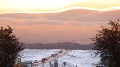
Up to 40 millimetres of rain and a multi-day, multi-format precipitation event are converging on the region — a combination that reframes the week’s headline as a snow storm southern ontario threat with hidden flood and ice hazards. Environment Canada has placed a special weather statement in effect for significant rainfall for Toronto and advisories across southern Ontario from Windsor to Cornwall.
How should residents and officials read the Snow Storm Southern Ontario forecast?
Verified facts: Environment Canada has forecast 20–40 millimetres of rain for Toronto and warned that a series of low-pressure systems will produce significant rainfall across parts of southern Ontario. The national agency noted heavy downpours may cause flash floods and water pooling on roads and that advisory statements may be escalated to rainfall warnings. Environment Canada also issued advisories for prolonged freezing rain in parts of central Ontario and the Bruce Peninsula, and a separate advisory for Petawawa indicating up to 10 millimetres of rainfall there.
Additional verified observations in the regional briefing outline a complex storm expected to deliver a mix of snow, freezing rain, ice pellets and rain across Ontario over a 24-plus-hour period. Prolonged freezing rain and ice pellets are targeted toward central and eastern zones, while southern Ontario faces localized and riverine flood risks. Flood watches are active for southern Ontario and flood warnings have been issued for communities along the Grand River, including Brantford, New Hamburg and Haldimand County.
Informed analysis: The simultaneous presence of heavy rain, freezing rain and a later temperature plunge increases the chance that high runoff will meet sudden surface icing and, in places, accumulating snowfall. That sequence — warm rain, rapid cooling, then freezing precipitation or snow — elevates the likelihood of both flooding and hazardous ice accretion. Meteorologist Bill Coulter has characterized March’s swings as deceptive: mild conditions can quickly give way to winter hazards, underscoring the need for layered preparedness rather than focusing on a single threat metric.
What are the immediate risks and who will be most affected?
Verified facts: The storm briefing identifies several tangible impacts. Southern Ontario can expect morning heavy rain and thunderstorms, shifting by evening to a wintry mix or snow as colder air moves south. Snowfall totals of 5–15+ centimetres are forecast from east of Lake Superior to North Bay; southern Ontario rainfall estimates of 20–40+ millimetres are noted. Freezing rain totals of 5–20+ millimetres are highlighted for Ottawa and eastern Ontario, with the caution that not all freezing rain will accrete equally depending on wind, precipitation rate and surface temperatures. Potential outcomes listed include power outages, slick untreated surfaces, flooding, ice jams, and broken tree limbs.
Informed analysis: The intersection of flash-flood potential in low-lying and riverine areas with the prospect of prolonged freezing rain creates a compound-risk scenario. Municipal services and emergency responders face the dual challenge of managing water overflow while preparing for power and infrastructure impacts from ice. Communities along the Grand River already under flood warning illustrate how quickly hydrological stress points can appear; at the same time, central and eastern corridors susceptible to prolonged freezing rain carry elevated risk of prolonged power disruption and fallen branches that can hamper response.
Verified facts: Day-to-day temperature swings cited in the forecast amplify risk complexity. Toronto’s forecast trajectory in the briefing shows mild daytime highs followed by evening drops — for example, a daytime high near 13 C dropping into single digits and then into negatives later in the week, with flurries possible as the air turns colder.
Accountability and next steps: The scale and variety of hazards embedded in this event demand clearer, coordinated public guidance and preemptive action. Environment Canada’s advisories establish the hazard footprint; local authorities and utilities must now translate that footprint into targeted protective measures for flood-prone corridors, power-sensitive infrastructure and communities expecting freezing rain. Residents should treat forecast windows as dynamic and prepare for rapid transitions between heavy rain, ice and snow. The coming updates from Environment Canada will determine whether advisories become warnings, and that progression should inform escalating operational responses from municipal emergency management, road crews and utility operators as the snow storm southern ontario unfolds.