Environment Canada has issued a special weather statement for the Grand River region this morning, flagging a risk of freezing rain and possible ice accretion that could make roads hazardous while already elevated water levels keep hydro and public-safety concerns high.
Freezing Rain, Ice Accretion and Travel Risks
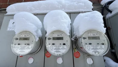
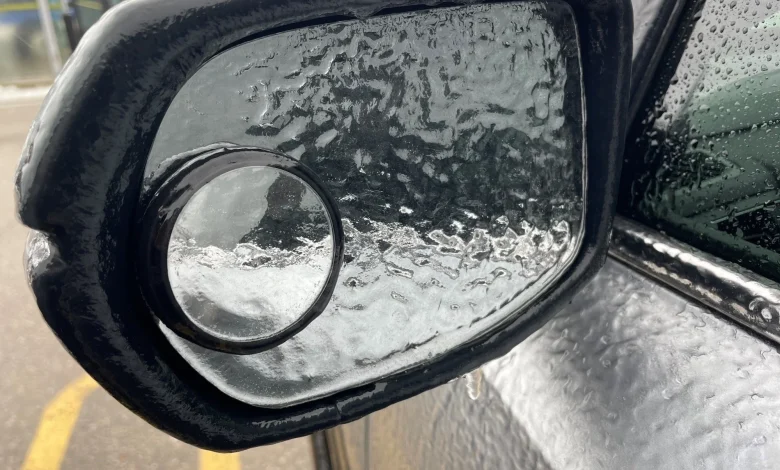
The special weather statement warns of freezing rain that may lead to ice accretion across the affected area, a condition likely to complicate travel on what has been a rough weekend for drivers. The forecast notes the rain should ease in the afternoon, but lingering icy surfaces are expected where precipitation falls at or below freezing.
Hydro And Flood Warnings Across Grand River Watershed
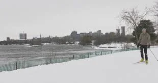
The Grand River Conservation Authority is maintaining a flood warning for Brant County, Brantford, Six Nations and Haldimand County and is issuing a Flood Watch for the remainder of the Grand River watershed. Warmer temperatures last weekend combined with recent rain have left water levels high, and residents are cautioned to stay away from riverbanks and other waterways because banks are likely to be very slippery. Observers have captured video of the Grand River flooding into low-lying areas of Schneider Park, and commuters described a scene of water pouring onto Highway 85 in Kitchener that resembled a waterfall.
High water and ongoing runoff are already stressing local channels and shoreline areas; officials emphasize that hydro impacts to banks and infrastructure remain a concern while levels stay elevated.
Wind Threats, Temperatures and Short-Term Outlook
Following the period of freezing rain, the forecast calls for a windier period with gusts expected up to 70 km/hr tonight and upwards of 80 km/hr tomorrow morning. Temperatures are expected to climb, reaching 9 degrees tonight and up to 11 degrees tomorrow afternoon, which will transition precipitation regimes but keep rain in the picture for tomorrow. Rainfall combined with strong gusts could worsen localized flooding and slippery conditions in exposed areas.
With the chance of additional rain tomorrow, residents are advised to plan for wet conditions and to exercise caution near waterways and on affected roads.
Public Safety Reminders and Local Disruption
Authorities remind the public to avoid standing near swollen rivers, to be cautious on travel routes that have seen water over pavements, and to give crews room to work on any affected infrastructure. The flood warning and flood watch remain active as conditions evolve, and people in low-lying or riverside locations should monitor official updates and heed any evacuation or safety advisories that may follow.
As conditions develop, the combination of freezing rain, high water and strong winds creates a layered hazard environment: icy surfaces can impair travel, elevated river levels pose flood risks, and gusty conditions can exacerbate the immediate dangers posed to shoreline assets and roadways.
Officials are monitoring the situation and will update alerts as needed; for now, the immediate priorities are travel safety, avoiding hazards near waterways, and preparing for continued wet and windy weather into the short term.