toronto weather is under a special weather statement as Environment Canada warns of significant rainfall beginning Tuesday night and continuing through Wednesday, with 20 to 40 millimetres expected in the city. The national agency says heavy downpours may cause flash flooding and pooling on roads across southern Ontario from Windsor to Cornwall. The advisory also flags prolonged freezing rain in parts of central Ontario and the Bruce Peninsula, and a sharp temperature swing later in the week.
Toronto Weather: Rain and flood risk
Environment Canada has placed Toronto and much of southern Ontario under advisories as a series of low-pressure systems moves through. The agency forecasts 20 to 40 millimetres of rain for Toronto, with localized heavier amounts where thunderstorms develop. “A series of low-pressure systems will lead to significant rainfall across parts of southern Ontario. Heavy downpours may cause flash floods and water pooling on roads, ” Environment Canada said, noting statements could be upgraded to rainfall warnings.
Advisories extend broadly across southern Ontario from Windsor in the west to Cornwall in the east, with flood watches and localized flood warnings already highlighted for vulnerable low-lying areas and river corridors. The national forecast warns that heavy downpours and rapid accumulation will increase the risk of pooling on urban streets and sudden runoff in suburban and rural catchments.
Freezing rain, ice pellets and temperature swings
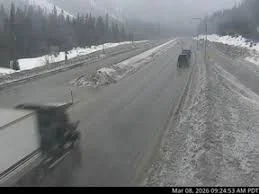
Alongside heavy rain, central Ontario and the Bruce Peninsula face a prolonged period of freezing rain. An advisory for Petawawa notes up to 10 millimetres of freezing precipitation could fall in that area, raising the prospect of slick untreated surfaces and damage to tree limbs. Forecasters also highlight the potential for ice pellets in parts of central and eastern Ontario and warn that freezing rain totals could reach several millimetres in more affected zones.
Temperatures in Toronto will be volatile this week: highs near 13 C Tuesday daytime falling to about 5 C by Tuesday evening, then around 11 C on Wednesday before plunging to roughly -3 C by Wednesday night. Later in the week, a marked cooldown is expected, with daytime highs near 1 C on Thursday and Friday and flurries possible on those days.
Immediate reactions
Environment Canada emphasized the need for preparedness as conditions change: “Heavy downpours may cause flash floods and water pooling on roads, “. Emergency-management officials in affected regions are monitoring river levels and urban drainage systems and advising residents to be ready for rapidly changing road and travel conditions.
Emergency planners and municipal road crews are expected to prioritize clearing storm drains and responding to localized flooding. Utility impacts from freezing rain and heavy wet snow are possible in areas that receive prolonged ice accretion, with emergency services noting that fallen branches and slick surfaces could create hazards.
What’s next
Residents should keep umbrellas and contingency plans ready as the pattern unfolds and watch for upgrades from advisories to formal warnings. Forecasts indicate the mix of heavy rain, freezing precipitation and a rapid temperature decline could complicate emergency response and travel through the latter half of the week. Stay alert for Environment Canada updates and local advisories as the situation evolves; toronto weather remains in a volatile phase with flood and ice risks continuing to develop.